


Mandeville Voting District, Miller County, Arkansas
About
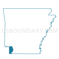
Outline

Summary
| Unique Area Identifier | 527307 |
| Name | Mandeville Voting District |
| County | Miller County |
| State | Arkansas |
| Area (square miles) | 118.58 |
| Land Area (square miles) | 115.40 |
| Water Area (square miles) | 3.18 |
| % of Land Area | 97.32 |
| % of Water Area | 2.68 |
| Latitude of the Internal Point | 33.52145190 |
| Longtitude of the Internal Point | -93.88297690 |
Maps


Graphs
Select a template below for downloading or customizing gragh for Mandeville Voting District, Miller County, Arkansas


Neighbors
Neighoring Voting District (by Name) Neighboring Voting District on the Map
- Voting District 0010, Bowie County, TX
- Voting District 006A, Bowie County, TX
- Bois Darc Voting District, Hempstead County, AR
- Boyd Hill Voting District, Lafayette County, AR
- Garland Precinct, Miller County, AR
- Johnson Voting District, Little River County, AR
- Rondo Precinct, Miller County, AR
- Shiloh Precinct, Miller County, AR
- Springhill Voting District, Hempstead County, AR
- Sugar Hill Precinct, Miller County, AR
- Trice Precinct 12, Miller County, AR
Top 10 Neighboring County Subdivision (by Population) Neighboring County Subdivision on the Map
- Texarkana CCD, Bowie County, TX (58,179)
- Garland township, Miller County, AR (33,493)
- Springhill township, Hempstead County, AR (1,520)
- Bois d'Arc township, Hempstead County, AR (690)
- Johnson township, Little River County, AR (631)
- Red River township, Miller County, AR (307)
- Homan township, Miller County, AR (144)
- Russell township, Lafayette County, AR (119)
Top 10 Neighboring Place (by Population) Neighboring Place on the Map
Top 10 Neighboring Unified School District (by Population) Neighboring Unified School District on the Map
- Texarkana School District, AR (32,645)
- Texarkana Independent School District, TX (31,638)
- Hope School District, AR (15,849)
- Pleasant Grove Independent School District, TX (11,867)
- Ashdown School District, AR (9,717)
- Lafayette County School District, AR (5,731)
- Spring Hill School District, AR (1,487)
Top 10 Neighboring State Legislative District Lower Chamber (by Population) Neighboring State Legislative District Lower Chamber on the Map
- State House District 1, TX (146,509)
- State House District 1, AR (28,441)
- State House District 2, AR (25,839)
- State House District 3, AR (25,835)
- State House District 4, AR (25,193)
Top 10 Neighboring State Legislative District Upper Chamber (by Population) Neighboring State Legislative District Upper Chamber on the Map
Top 10 Neighboring 111th Congressional District (by Population) Neighboring 111th Congressional District on the Map
Top 10 Neighboring Census Tract (by Population) Neighboring Census Tract on the Map
- Census Tract 209, Miller County, AR (8,076)
- Census Tract 109.01, Bowie County, TX (7,446)
- Census Tract 112, Bowie County, TX (5,867)
- Census Tract 301.02, Little River County, AR (5,385)
- Census Tract 4701, Lafayette County, AR (4,728)
- Census Tract 4804, Hempstead County, AR (3,972)
- Census Tract 4802, Hempstead County, AR (2,771)
- Census Tract 208.01, Miller County, AR (2,768)
Top 10 Neighboring 5-Digit ZIP Code Tabulation Area (by Population) Neighboring 5-Digit ZIP Code Tabulation Area on the Map
- 71854, AR (36,438)
- 75503, TX (24,379)
- 71801, AR (16,745)
- 71845, AR (2,387)
- 71838, AR (1,148)
- 71853, AR (365)